


My Hurricane Tracker & Alerts
4.7871.00 Reviews
App Specs
- Version
- 26.4.1
- Updated On
- License
- Free
- Downloads
- 500,000+
- Developer
- JRustonApps B.V.
- Categories
- Weather
- Platform
- Android
Screenshots
 Analysis by AppCompare
When severe weather becomes a possibility, a normal daily forecast is often too broad to be useful. I may need to know whether a tropical system is moving toward a planned route, whether a warning area is changing, or whether I should keep checking conditions before leaving home. My Hurricane Tracker & Alerts is built around that more focused problem. It is a free weather app from JRustonApps B.V. that brings hurricane, tornado, and cyclone information into one place instead of treating every weather event like an ordinary sunny-or-rainy forecast.
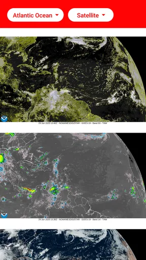
After using it, I see the app less as a replacement for my everyday weather service and more as a specialist tool I open when a storm deserves closer attention. Its strongest idea is the combination of detailed forecasts and maps. That combination matters because a storm’s name or current position tells me very little on its own. I need movement, projected direction, and a visual sense of how the system relates to places I care about.
The app has earned a 4.7 average from around 13 thousand ratings, with over 500 thousand installs. Those figures suggest it has found a clear audience among people who want more than a basic weather widget. It is rated for Everyone, costs nothing to install, and runs on Android from version 8.0 onward. The current release is 26.4.1, so it is also accessible to people using older compatible phones rather than only recent devices.
Why the map-centered approach is the real strength
I find the map most valuable when I use it to compare a storm’s changing position with places I actually need to think about, rather than treating the display as a dramatic snapshot. That habit makes the view more useful for planning and less likely to create false certainty. The next section looks at a practical routine for checking those changes as a system develops.
A storm map answers questions a daily forecast cannot
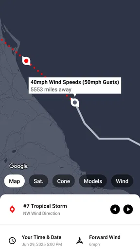
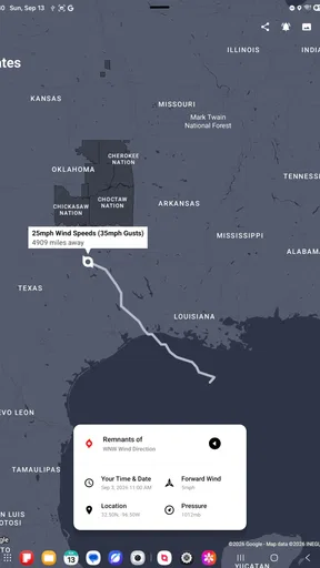
The most useful capability here is the map-based way of following dangerous weather. A standard weather app may show rain icons, wind speeds, or a warning banner for a general area. That is helpful for routine planning, but it can feel vague during a developing hurricane or cyclone. A map gives me a more practical frame of reference: where the system is, which direction it appears to be taking, and how its projected path relates to a coastline, city, airport, or travel route.
I find that visual context changes how I read a forecast. Instead of reacting to a single alarming word, I can look at the storm as a moving system. A projected path is not a promise, and I would never treat the outer edge of a forecast area as a precise boundary. Still, seeing the track helps me understand uncertainty better than reading isolated numbers in a list. The app is at its best when I use it to build awareness over time rather than check it once and make a final decision.
That distinction is important. This is not simply a regular weather app with a storm icon added to the home screen. Its purpose is narrower and more useful during active tropical systems or severe weather situations. The focus makes the experience easier to understand when I am specifically looking for storm movement, but it also means the app is not necessarily the first tool I would open for a normal commute, a picnic, or a quick look at tomorrow’s temperature.
Worth Reading Before You Choose

EA SPORTS FC Mobile 26 Is a Bigger Football Game, but It Takes Time

Flipboard Shows What News Apps Must Do Beyond the Feed

Switching to Android Auto Means Rethinking Your Driving Routine

Google Calendar Makes a Crowded Week Easier to Manage

Ludo King Makes the Most of the Minutes Between Plans

Baby Panda World Brings Quick Play to Modern Phones, but Its Game Library Feels Busy
Forecasts become more useful when I compare them with location
A forecast only becomes meaningful when I connect it to a real place. I might be watching a storm while staying near the coast, planning a flight, or checking on family in another region. The map lets me think in terms of distance and direction instead of relying on a generic headline. That is one of the app’s less obvious advantages: it encourages a more careful reading of risk.
For example, a projected center may remain far from my location while the surrounding weather still affects travel, power, or outdoor plans. Conversely, a large-looking map display does not automatically mean that every visible area faces the same danger. I use the map as a starting point for questions, not as a substitute for local emergency guidance. The app helps me see the broader situation, while official local alerts remain the place I would turn to for evacuation instructions or immediate safety decisions.
The practical value is not prediction by itself; it is better context for deciding what to check next. That is why the app feels more useful to me during a multi-day weather event than during a brief shower. I can return to the same storm and notice how its expected path has changed, rather than treating each update as an unrelated notification.
Hurricanes, tornadoes, and cyclones need different kinds of attention
The app covers hurricanes, tornadoes, and cyclones, which makes it relevant across several forms of severe weather. These events do not behave in the same way, and I would not use one mental model for all of them. A tropical system may be followed across a broader area over time, while a tornado situation can demand immediate attention over a much smaller zone. The app’s broad coverage is useful because I do not need a separate storm-tracking concept for every event.
At the same time, I would avoid assuming that a single map can replace specialized local information for every hazard. Tornado conditions can change quickly, and a broad tracking view may not provide the immediacy of local emergency broadcasts. For a hurricane or cyclone, the longer tracking perspective is more naturally suited to planning. For a tornado, I would treat the app as an additional source of awareness and keep local warnings, sirens, and official instructions in the foreground.
How I use it when a storm is actually developing
When a storm is developing, I try to make each check answer a specific question: has the projected movement changed, and does that affect a route or someone I care about? Looking at the map before travel and revisiting it after an alert helps me turn updates into a reasoned reassessment, not an automatic change of plans. I also keep local warnings in the picture, especially when timing becomes urgent.
My routine starts with a broad look, not constant refreshing
When I first hear about a storm, I open the app to understand the overall picture. I look at the relevant map, identify the system’s current position, and consider whether the projected direction intersects with places that matter to me. I do not immediately jump to a conclusion based on one update. Instead, I use the first view to decide whether I need to monitor the situation more closely.
That workflow keeps the app from becoming a source of unnecessary anxiety. Severe-weather maps can look dramatic, especially when a forecast area covers a wide region. A calm first pass helps me separate what is happening now from what may happen later. I then compare the app’s information with local weather services and official announcements before making decisions involving travel or safety.
On later checks, I pay attention to changes rather than merely reopening the app out of habit. Has the projected path shifted? Is the system closer to the location I care about? Has the situation moved from distant planning to something that could affect my next few hours? This is a more disciplined use of the app than repeatedly staring at the same map without a question in mind.
Alerts are useful only when I treat them as prompts
The title emphasizes alerts, and that is an important part of the app’s appeal. An alert can save me from having to remember to check manually, particularly when weather conditions develop while I am working or sleeping. I see alerts as prompts to investigate, not as complete explanations. A notification may tell me that something deserves attention, but I still need to open the relevant information and understand what it means for my location.
This is also where I would be careful with phone settings. If notifications are blocked, muted, or restricted by the operating system, an alert-based workflow becomes less dependable. I would check the app’s notification settings and the phone’s own permissions before relying on it during an important weather event. That is not a flaw unique to this app, but it is an easy practical detail to overlook.
I also avoid treating an alert as a reason to panic. Weather services update forecasts as new observations arrive, and a notification can reflect a change in the situation without meaning that immediate danger is present at my exact address. The best habit is to use the alert as a reminder to review the map, read the current forecast, and consult local authorities when the situation is serious.
A realistic travel-day example
Imagine I am due to drive along a coastal route while a tropical system is being monitored. A normal weather app might tell me that rain and strong wind are possible, but that does not answer the questions I actually have. Is the storm moving toward the route? Is the projected track changing? Should I leave earlier, choose a different road, or postpone the trip?
I would open this app before leaving and use the map to understand the storm’s position and expected movement. I would then check local road information, airport or transport updates if relevant, and official warnings for the places along the route. If the app sends an alert later, I would reassess rather than assume my original plan is still valid. The app does not make the decision for me, but it makes the weather part of that decision easier to visualize.
The same process works for someone checking on relatives in another region. I can follow the wider system without pretending that a national forecast tells me exactly what is happening at their home. I would still ask them to follow local instructions, but the map gives me a shared reference when discussing the storm with them.
What I would do before relying on it
I would install and explore the app before storm season rather than waiting until a warning is already active. That gives me time to become familiar with its map view, notification behavior, and location workflow. I would also make sure the phone has enough battery and that I have another way to receive official emergency messages. A tracking app is only one part of a sensible severe-weather plan.
If I travel, I would review the app while connected to a reliable network and avoid assuming that every map detail will remain available in a place with weak reception. I would save important local emergency contacts separately and tell family members where I am going. These steps may sound obvious, but they prevent me from placing too much responsibility on a single app during a stressful situation.
Where the experience falls short
The main drawback is that a storm-tracking view can invite more confidence than a forecast deserves, while alerts are only useful if phone settings let them reach me and I take time to interpret them. I also wouldn’t expect a specialist tracker to replace a daily forecast or a local emergency channel. Those trade-offs matter most for people who want a simple, definitive answer rather than context they must judge.
It is specialized, not a complete replacement for everyday weather
The biggest trade-off is focus. If I mainly want hourly temperatures, a simple rain forecast, pollen information, or a quick home-screen glance, a conventional weather app may be more convenient. This app earns its place when I need storm tracking. For ordinary daily weather, its specialist purpose can feel like more information than I need.
I would therefore keep my usual weather app if I already like its local forecast and use this one alongside it. The two tools answer different questions. A general service is usually better for deciding what jacket to wear this afternoon. My Hurricane Tracker & Alerts is better when I want to understand a named or developing severe-weather system in relation to a broader area.
Maps can create a false sense of precision
A clean projected path is easy to interpret as a guarantee, even though weather forecasting involves uncertainty. The farther into the future I look, the more cautious I become. I do not read the edge of a projected area as a sharp line separating safety from danger. Conditions outside a central path can still be serious, and conditions inside a broad area will not necessarily be identical everywhere.
This is a limitation of how people read maps as much as a limitation of the app itself. The visual format is powerful, but it can encourage overconfidence. I get the best results when I compare successive updates, look at the local implications, and use official guidance for action. If someone wants a single yes-or-no answer about whether it is safe to travel, this app cannot responsibly provide that on its own.
Severe weather demands more immediacy than one tracker can provide
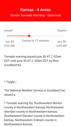
For fast-moving hazards, especially tornado situations, I would not depend solely on a tracker. Local emergency alerts, weather radio, broadcasters, and authorities may provide more immediate instructions for a specific neighborhood. The app is valuable as part of a wider information setup, but it should not become the only channel I monitor.
This is also why I would be cautious about using it for someone who is unfamiliar with weather maps. A new user may need time to learn the difference between a current position, a projected path, and a broader area of possible impact. The app can support understanding, but it does not remove the need for judgment. A family member who wants very simple alerts may prefer a local emergency notification system with fewer layers to interpret.
Alerts require attention and sensible settings
Alerts can be helpful, but they can also interrupt me at inconvenient times or become easy to dismiss if too many notifications arrive. I would adjust them thoughtfully and avoid turning every possible update into an emergency in my own mind. The goal is to receive a useful prompt without creating notification fatigue.
I would also check the app after installing it on a secondary device or an older phone. Since it supports Android from version 8.0, it is suitable for a wide range of compatible devices, but the experience can still vary with screen size, battery settings, and network quality. A map that is comfortable on a large modern display may require more zooming and panning on a small older handset.
Who gets the most from this app
I think this app makes the most sense for people whose travel, work, home, or family plans can be affected by severe weather, particularly when they want to follow a system across a wider area. It is less compelling if all you need is a quick temperature check or immediate neighborhood instructions. I’ll close by weighing that focused role against the everyday alternatives and explaining when I’d keep it installed.
It suits people who need storm context
I recommend it most strongly to coastal residents, frequent travelers, outdoor workers, and people who regularly monitor weather for family members in storm-prone regions. It is also useful for anyone who finds ordinary forecast cards too limited during a hurricane or cyclone. The map-centered view gives these users a way to follow the event as it develops instead of checking disconnected headlines.
People who plan trips well in advance may appreciate it too. A storm can affect a journey before it directly reaches the destination, through changing routes, delays, or difficult conditions along the way. The app helps me notice that broader possibility earlier, although I still need transport providers and local authorities for operational decisions.
Its free price makes it easy to keep available even if I only use it occasionally. That matters for a specialist tool: I do not need to justify a regular subscription for something I may open only during a few significant weather events. The Everyone age rating also makes it suitable for a household device, provided younger users understand that maps and alerts are information to discuss with an adult rather than instructions to interpret alone.
Who should choose something else or use it only as a companion
I would not make this my only weather app if my priorities are routine forecasts, detailed local conditions, or a minimal interface for checking the next few hours. A standard weather service may be faster for those tasks. I would also look elsewhere, or use this only as a supplement, if my main concern is immediate neighborhood-level emergency communication during rapidly changing events.
Someone who dislikes maps may find the app less approachable than a simple warning feed. The visual format is one of its strengths, but it also asks me to interpret movement and uncertainty. If I want a single large warning with very little context, a local alert system may be a better fit.
For me, the best arrangement is complementary: a regular weather app for daily life, local authorities for urgent instructions, and this tracker for seeing the wider storm picture. That division of labor avoids asking one application to do everything.
My final assessment after using it
My Hurricane Tracker & Alerts succeeds because it concentrates on a real weakness in ordinary weather apps: they often tell me that severe weather exists without helping me understand how the system relates to the places and plans that matter. Its forecasts and maps turn storm monitoring into a more visual, repeatable process. I can check the broader movement, respond to alerts, and decide which local information deserves my attention next.
It is not a guarantee of safety, a replacement for emergency services, or the most convenient choice for a normal morning forecast. The map can be misread, alerts need sensible phone settings, and fast-moving hazards require additional official sources. Those limits are important, but they do not cancel out the app’s central value.
I would keep it installed as a focused companion for hurricanes, tornadoes, and cyclones. If severe weather affects your travel, home, work, or family decisions, the ability to see a storm in context is more useful than another generic forecast card. If you only want everyday temperature and rain information, a conventional weather app will probably serve you better. For the right user, though, this free tool provides a practical way to stay oriented without pretending that a map can replace good judgment.
Pros
- Provides timely hurricane forecasts and storm-tracking updates.
- Interactive maps make projected paths easy to follow.
- Push alerts can warn users about nearby tropical threats.
- Covers hurricanes and tropical storms worldwide.
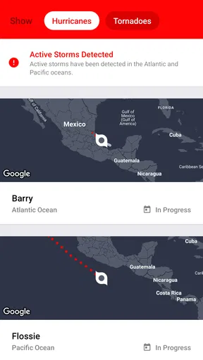
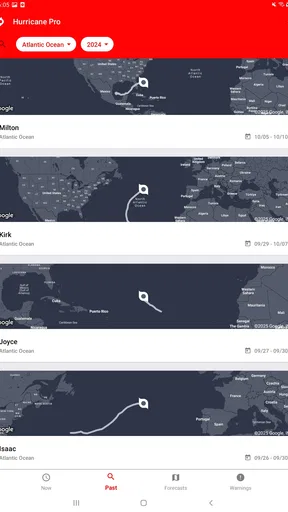
- Useful for monitoring multiple active storms in one place.
Cons
- Some advanced features may require a paid subscription.
- Forecast paths can change quickly and may cause confusion.
- Frequent alerts may feel excessive during busy storm seasons.
- Ad-supported screens can make navigation less convenient.
- It should supplement
- not replace
- official emergency warnings.
FAQs for My Hurricane Tracker & Alerts
What is My Hurricane Tracker & Alerts used for?
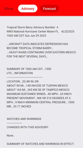
My Hurricane Tracker & Alerts is designed to help users monitor hurricanes, tropical storms, and other significant weather systems. It provides storm maps, projected paths, current locations, wind information, and alerts that can help you stay informed during an active season. The app is useful for residents, travelers, boaters, and anyone following storms in the Atlantic, Pacific, or other supported regions.
Does My Hurricane Tracker & Alerts provide real-time hurricane alerts?
The app can provide notifications and updates about developing tropical systems, but the exact alert coverage may depend on your location, device settings, internet connection, and the services supported by the current version. It is important to enable notifications and location permissions if requested. For evacuation orders, emergency instructions, and official warnings, always confirm information with local authorities and national weather agencies.
Can I use the app to track a hurricane’s projected path and strength?
Yes, one of the main features is the ability to view storm locations and forecast tracks on an interactive map. Depending on the storm and available data, you may also see details such as wind speed, category, pressure, movement, and forecast updates. Remember that projected paths can change quickly, so the app should be used for awareness rather than as a substitute for official emergency guidance.
Is My Hurricane Tracker & Alerts free to download and use?
My Hurricane Tracker & Alerts may be available as a free download, although some features can vary between Android and iOS versions. The app may include advertising, optional purchases, or premium tools depending on the edition installed from the official store. Before downloading, review the listing for current pricing, subscriptions, included features, and any in-app purchase information that may apply to your device.
Does My Hurricane Tracker & Alerts work without an internet connection?
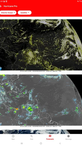
The app generally needs an internet connection to retrieve current storm positions, updated forecasts, radar information, maps, and newly issued alerts. Previously loaded screens or saved information may remain visible temporarily, but they should not be considered current during a rapidly changing emergency. For better reliability, keep mobile data or Wi-Fi available and prepare alternative sources of official weather information before a storm arrives.


